 Time Travel Active
Name:
AA4HI
Station ID:
1506539
Source:
Symbol:
 Kenwood HT
Latest Packet:
Position Packet
Receive Time:
05/10/2025 7:26:26 PM+00:00
Age:
24 days ago
Path:
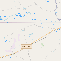
S6RV9P,WIDE1-1,WIDE2-1,qAR,AA4HI-4
Comment:
>&
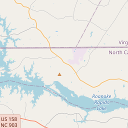
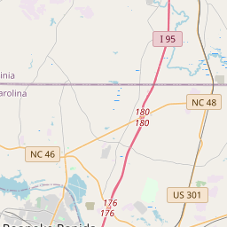
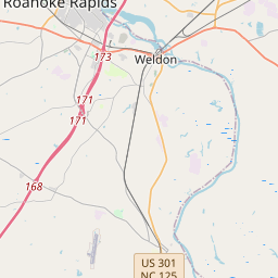
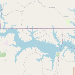
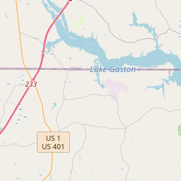
Latest Position:
36.44833, -77.63567
Receive Time:
(Received in latest packet)
Speed:
0 km/h
Course:
179°
Altitude:
65 m
Packet frequency:
48404s (Latest 2 packets)


- The specified "Station ID" is the ID that this station has on this website, this ID is useful when creating a link to this website. Read more in the About/FAQ.
- To get a better understanding of the APRS path I recommend reading the explanation written by wa8lmf.
- If this packet has the "Posambiguity"-mark it means that the sent position is ambiguous (a configured number of digits has been truncated from the end of the position).
- PHG stands for Power-Height-Gain (and directivity). The height is not the height above sea-level, it is the height above average terrain (HAAT = Height Above Average Terrain). PHG is used to calculate the relative RF range of a station. If this station has reported several positions or symbols the PHG data will only be used for the position and symbol used in the PHG-packet.
- RNG is the "pre-calculated omni-directional radio range" of the station (reported by the station itself). If this station has reported several positions or symbols the RNG data will only be used for the position and symbol used in the RNG-packet. It seems like many D-STAR station use the RNG value to specifify D-STAR range.
- One object may be sent by several different senders. On the map they may share the same path, but they all have their own "Station information" modal.
- If station has more than 15 related stations we will only show the 10 closest related stations.