 Time Travel Active
Name:
9W2KHE-4
Station ID:
1163609
Source:
Symbol:
 Red Diamond (with overlay L)
Latest Packet:
Position Packet
Receive Time:
06/12/2025 1:45:18 AM+00:00
Age:
3 minutes ago
Path:
APLRG1,TCPIP*,qAC,T2FINLAND
Comment:
Bandar Dato' Onn LoRa iGate 433.400MHz http://www.qrz.com/db/9w2khe 14 Dec 2024 HELTEC LoRa32 Diamond X50A Batt=4.20V
Latest Weather:
01/05/2025 1:38:53 PM+00:00
Comment/Software:
Bandar Dato' Onn LoRa iGate & WX Station 433.400MHz http://www.qrz.com/db/9w2khe 14 Dec 2024 | HELTEC WireleSs Stick V3 Diamond X50A (UHF gain 7.2dB) 300Mbps Upload
Latest Telemetry:
11/25/2024 5:21:04 PM+00:00
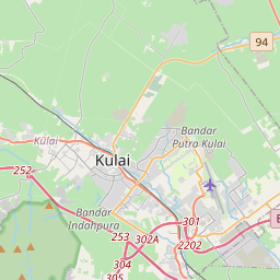
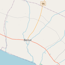
Latest Position:
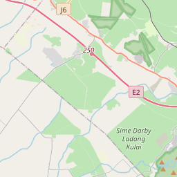
1.5698, 103.7346
Receive Time:
(Received in latest packet)
Packet frequency:
900s (Latest 9 packets)
")


- The specified "Station ID" is the ID that this station has on this website, this ID is useful when creating a link to this website. Read more in the About/FAQ.
- To get a better understanding of the APRS path I recommend reading the explanation written by wa8lmf.
- If this packet has the "Posambiguity"-mark it means that the sent position is ambiguous (a configured number of digits has been truncated from the end of the position).
- PHG stands for Power-Height-Gain (and directivity). The height is not the height above sea-level, it is the height above average terrain (HAAT = Height Above Average Terrain). PHG is used to calculate the relative RF range of a station. If this station has reported several positions or symbols the PHG data will only be used for the position and symbol used in the PHG-packet.
- RNG is the "pre-calculated omni-directional radio range" of the station (reported by the station itself). If this station has reported several positions or symbols the RNG data will only be used for the position and symbol used in the RNG-packet. It seems like many D-STAR station use the RNG value to specifify D-STAR range.
- One object may be sent by several different senders. On the map they may share the same path, but they all have their own "Station information" modal.
- If station has more than 15 related stations we will only show the 10 closest related stations.